Thursday, December 15, 2011

MMC Christmas Concert

Here are some pictures of the Miles Mac Choir from yesterday, December 14, 2011. A wonderful Christmas musical extravaganza, and especially, a great choir!


The full choir


 Even room for some humour


The full choir with Guitar


 The child prodigy


Simply myself, Mom N & Mom S


Esther, Susan, Daniel, & Jada

Saturday, December 3, 2011

Finding some 6 strings

Dennis

Was out one day and took some pictures of guitars I liked.

The first is a Martin DX1E with solid spruce top, HPL back and sides, Piezo Pickup with electronics for ~$650. Probably one of my two top picks although I didn't plug it in! Very eye catching contrast in wood colours.


Next is a  DV-4 Guild with solid Sitka Spruce Top, Rosewood back and sides, no electronics for around $840. Very nice!


 For something different, I saw this Tanglewood Sundance TW45, solid Canadian cedar top, African mahogany, Rosewood Fingerboard. A bit thin and ~$990.


The classic work horse  Gibson J-45. Gibson Acoustic’s J-45 comes equipped with the popular Element Active Acoustic Pickup System from L.R. Baggs, which features a low-profile undersaddle element—or transducer—that’s proven more stable and durable than many standard ribbon-type pickup. Prices are around $2250.


Two other pictures of Gibson classics. Front is a Gibson Songwriter with standard cutaway for ~$3000 and aft is a  J-45 for $2200.

I am sure, now at Christmas, better deals might be had. I also have seen some nice Yamaha's but I only really like ones for around $1000.

Let me know if you have any interst. Like I said, the first two are ones I would buy for sound and feel. The Gibson guitars are more of the 'right' selection but I don't think they sound better.

Cheers.

Sunday, July 3, 2011

Birds Hill PP and the Bridge over Hwy #59

Recently I took a better look at the new (but not finished) bridge over Highway # 59 at the Birds Hill Provincial Park. This is looking south, towards Winnipeg.


Here are some closer shots of the structure from below. Last I saw it there were poles going over the whole bridge from one end to the other, kind of like a long chuck wagon. It will then be screened in to keep people from falling off or what ever.


Below are some shots of Dunning Road crossing the Winnipeg Floodway. Notice the lack of water in the floodway leaving the way to ride 'through' the waters. No connection with the new bridge made yet, but soon I suspect. The ride (bike) would be a little rough from one side to the other.


If you look back a few posts to where I pictorial ride up to Dunning Road, you will see very similar shots but the floodway is being used by much water.

Saturday, May 7, 2011

Art at the Forks from February 2011!

Sunday, February 13, 2011


You'll always find something going on at the Forks Market at the heart of Winnipeg.  Of course, outside the local residents are doing life with the help of man made structures.


 On this day we found Winnipeg artists showing off their works and works in progress - doing the hardest thing as a young artist - working in the public eye.


Creating and polishing work to sell in an auction later.


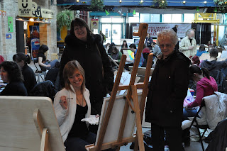
Here is a three generation trio - Mom & Grandma, Daughter & Aunt, and Niece and Granddaughter!  All interested in expression through art.


Pleasant conversations.


More that just art!


Working on the auction piece.


This piece auctioned off for a great sum!


A friend?


Some lovely paintings of Orchids.


And more.

Thursday, April 28, 2011

Biking from the NEPG (Northeast Pioneers Greenway) to BHPP (Birds Hill Provincial Park)

Tuesday, April 26, was the perfect bike ride evening - nice temperature and no wind.  I thought about going to the Chief Pegius Trail extension meeting at Douglas Mennonite Church but remembered it was to be held on Monday, the night before.

Stepped up to the plate to answer the question from a previous post - where does the human power only path go to on the floodway north of Hwy #59 and how does it connect with the new bridge over Hwy #59 at the BHPP.

Hit the road . . .


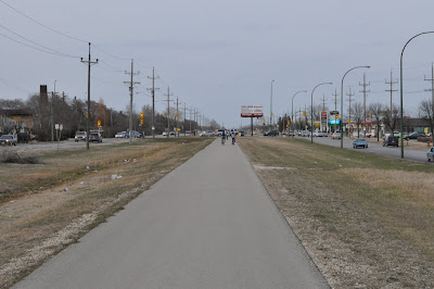
 Jumped on the NEPG just south of McLeod - nice path surrounded by lots of traffic.


 North of McLeod it continues by a rest stop.


 A little farther is an active area of the path.


Here is the first indication of the Chief Peguis Trail extension making its way east across the NEPG.  It should shut down the path for quite a while!  See an illustration on a previous post on the human power bridge over the new Trail on the west side.


North of McIvor the asphalt ends and the gravel continues.  A little rough but with some quarter down it would be much better.  The shelter indicates that more upgrades are coming!


North of Headmaster the path gets pristine - very nice!


 And then the north perimeter #101 and traffic.  Another bridge for safety?  Had a pleasant chat with a young man of 85 who loved biking down the path at this point, talking bike path stuff.


North of the Perimeter back to gravel path with asphalt for a while. This is where I used Raleigh going north instead of the path - no traffic and a better ride.


Crossing at Prichard Farm Road.


 Road changes to rutted gravel for a while.


At the end of Raleigh it's back to asphalt with the path of gravel.


A look right (east) along Hoddinott for a short piece.  You can see the lights at Birds Hill Road.


 Turning north along Birds Hill Road for another short ride on streets.


Turning east again along Garvin Road to get to the floodway.


Down Garvin Road.


The parking lot at the end of Garvin Road on the top of the west bank of the Floodway.


Looking south to Hwy #59 bridge over the floodway.


The path midway along the west side of the floodway.


The current end of the path at Dunning Road.  Who knows if the path will eventually continue north to Lockport?


Looking north over the flooded Dunning Road towards BHPP.


At this point, without a bike that can ride on water, my ride ends.  There might be no plans to "jump the pond" here so usage might only be for times of no flood water.  Considering the extent of the bridge being built over Hwy #59 north of the BHPP entrance it is hard to guess. Love to see some plans but I'm not sure that is up for public consumption.  This is based on my perception that the public does not even know that the path I rode on exists.


Very beautiful though, with noise from the highways the only shout that the outside world is still whirring!


From here you can see the car entrance to the BHPP - not very far to go . . .


And even a prairie sunset over the hill!


Well, its time to go home.  This point is 15.5k from home and a nice ride at that.  Kind of stuck thought, to get to BHPP unless I travel on Hwy #59 which I don't want to do so here's to the floodway drying up, the new bridge over #59 being completed and connected so I can have that picnic.

-